
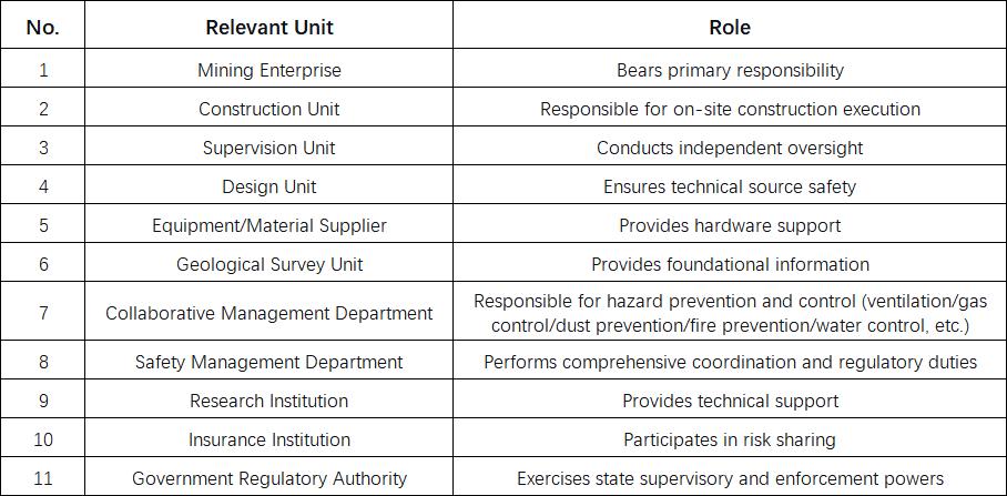
From "Labor-Intensive Excavation" to "Intelligent Excavation": 3D Geological Modeling Drives a Safety Revolution in Roadway Development
2025-01-18Real-World Challenges in Roadway Excavation Safety
China's coal mining is predominantly underground, requiring the excavation of vast amounts of roadway annually (approximately 13,000 km/year), ranking first in the world in terms of project scale.
Roadway excavation is a critical preliminary step in coal mining, creating passageways for subsequent processes such as coal extraction and transportation. Its safe and efficient progress directly impacts the continuity and overall profitability of coal production.

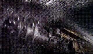
However, current excavation operations face complex and variable geological conditions, uneven technological development, low levels of mechanization and automation, high personnel density, significant accident risks, and harsh working environments. There are approximately 16,000 excavation faces nationwide, with over 700,000 workers engaged in excavation and support operations, heavily reliant on manual labor. Additionally, excavation faces are severely threatened by disasters such as water inrushes, gas outbursts, roof collapses, dust, and rock bursts.
Roadway excavation safety is a systematic engineering challenge requiring coordinated efforts across multiple stages, where oversight in any link can create potential accident hazards.
The Vital Role of 3D Geological Modeling
Therefore, from exploration and design to construction, every stage of roadway excavation must meet requirements for visibility, traceability, and predictability.
Traditional roadway excavation design primarily relies on static geological reports, such as 2D geological maps and data tables, limited manual exploration data, and predetermined design parameters. This approach struggles to effectively respond to sudden geological changes like faults or water surges. This traditional design model is experience-driven, plagued by delayed responses, difficulties in updates, and high professional barriers. The results are often inaccurate, difficult to interpret, and lack support for visual analysis. This hinders unified management and fails to meet the planning needs of decision-makers. Roadway excavation is undergoing a paradigm shift from "experience-based and static" to "data-driven and dynamic." 3D geological modeling is the foundation for realizing this transformation and the core of achieving geological transparency.
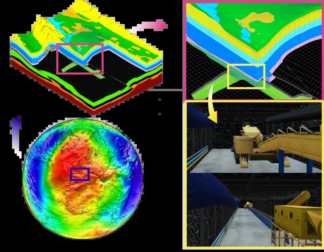
The geological sphere is evolving from "flat maps" to "3D sandboxes." Previously, roadway excavation relied on the experience and intuition of seasoned experts. Now, data must lead the way. By slicing strata into 3D building blocks and assembling them into a "transparent earth" that is both visible and calculable, this is the essence of 3D geological modeling. For excavation design, this high-precision 3D geological "building block" is first placed on the table, overlaid with the roadway BIM. Workers, managers, and clients can then see at a glance where excavation is feasible, where water or gas hazards lurk—all communicated through the model.
The engine for this safety revolution, transitioning from "labor-intensive excavation" to "intelligent excavation," has been ignited. 3D geological modeling is making roadways thousands of meters underground increasingly "transparent." Next, we will delve into the roadways to explore how high-precision geological models pave the way for safer, more efficient intelligent excavation—progressing from geological transparency to adaptive design and reduced human intervention in operations. Stay tuned!