
Breaking Through Mountainous Modeling Challenges! Chongqing Practices Lay a Solid Foundation for GRIDWORLD’s Deep Earth Exploration Technology
2026-03-26The 2026 National Two Sessions focused on deep earth exploration, geological informatization and the development and utilization of natural resources. Marching into the deep earth and building a resource security barrier through scientific and technological innovation have become heated topics. As a "tough nut to crack" in geological informatization, 3D geological modeling in mountainous areas faces far more difficulties than in plain regions. Due to steep terrain, fractured strata, dense faults, limited borehole arrangement and sparse data, traditional modeling is trapped in the dilemmas of "insufficient accuracy, difficult stitching and low efficiency", which has become a key constraint for territorial spatial planning and underground space development in mountainous areas.
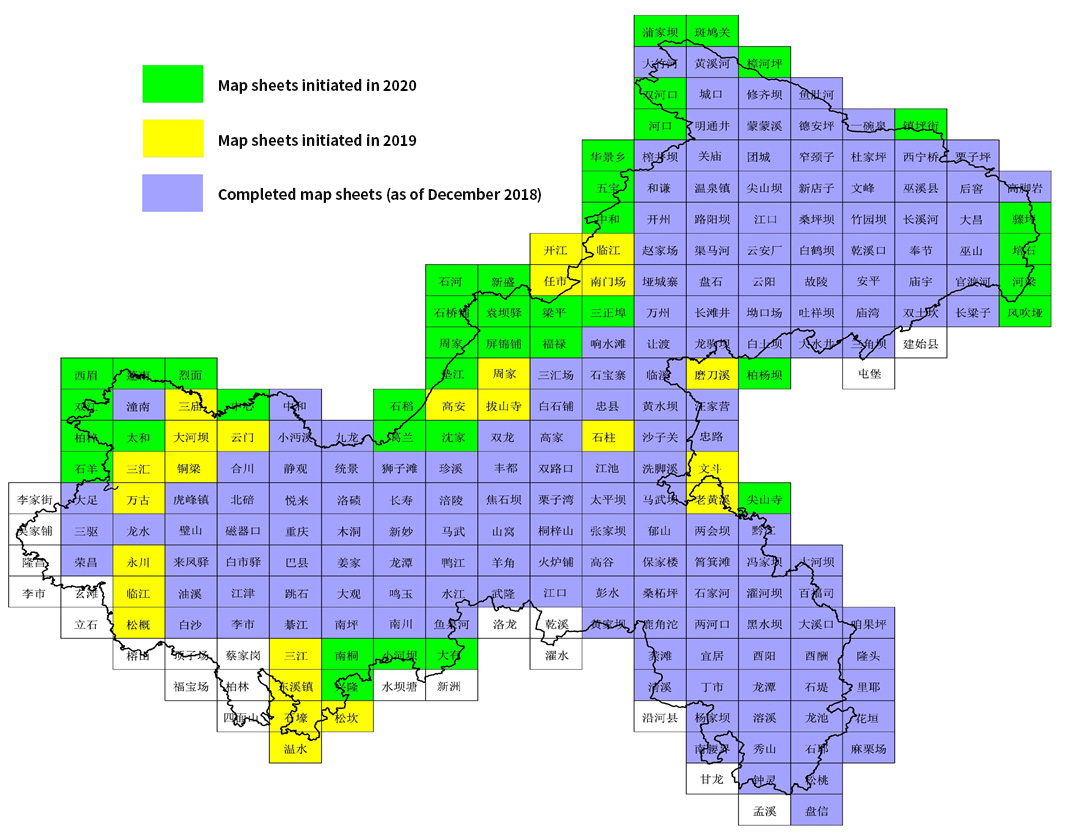
To tackle this problem, Chongqing Institute of Geology and Mineral Resources has joined hands with GRIDWORLD, taking technological innovation as the core. Relying onDepthInsight, GRIDWORLD’s independently developed geoscientific modeling software for deep exploration, the two sides have strived inChongqing 1:50,000 Regional Geological Survey 3D Geological Modeling—China’s first provincial-level full-domain 1:50,000 3D modeling project. Covering an area of 82,400 square kilometers and taking 3 years to complete, the project serves as a natural "testing ground" for mountainous modeling thanks to Chongqing’s complex structure, where 75% of the area is mountainous and 95% is covered by sedimentary rocks. GRIDWORLD has become the core support of the project with its software advantages.
Resolving Structural Modeling Difficulties
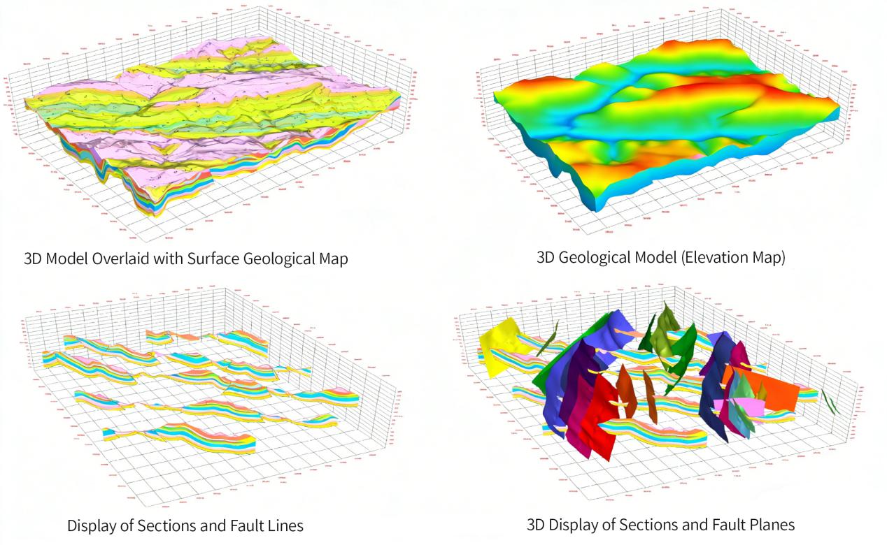
Faced with the complex stratigraphic classification and dense faults in Chongqing’s mountainous areas, the structural interpretation and modeling module of DepthInsight has shown strong adaptability. The project integrated 1:50,000 regional geological maps, 37,000 key geological boreholes, 879 km of 2D seismic data and 42 km² of 3D seismic geophysical data. Through multi-source data fusion technology, the software accurately depicted surface geological boundaries and effectively solved the stitching problems of different map sheets and strata. For areas with numerous fracture zones and scattered lithologic distribution, the software innovatively adopted overlapping region fusion and stratigraphic grid matching technologies, realizing seamless connection of cross-sheet structures and strata. The maximum single stitching area reached 11,250 km², with precision fully meeting project requirements.
(3D Geological Modeling of Complex Structures in Mingtongjing Sheet, Northeast Chongqing)
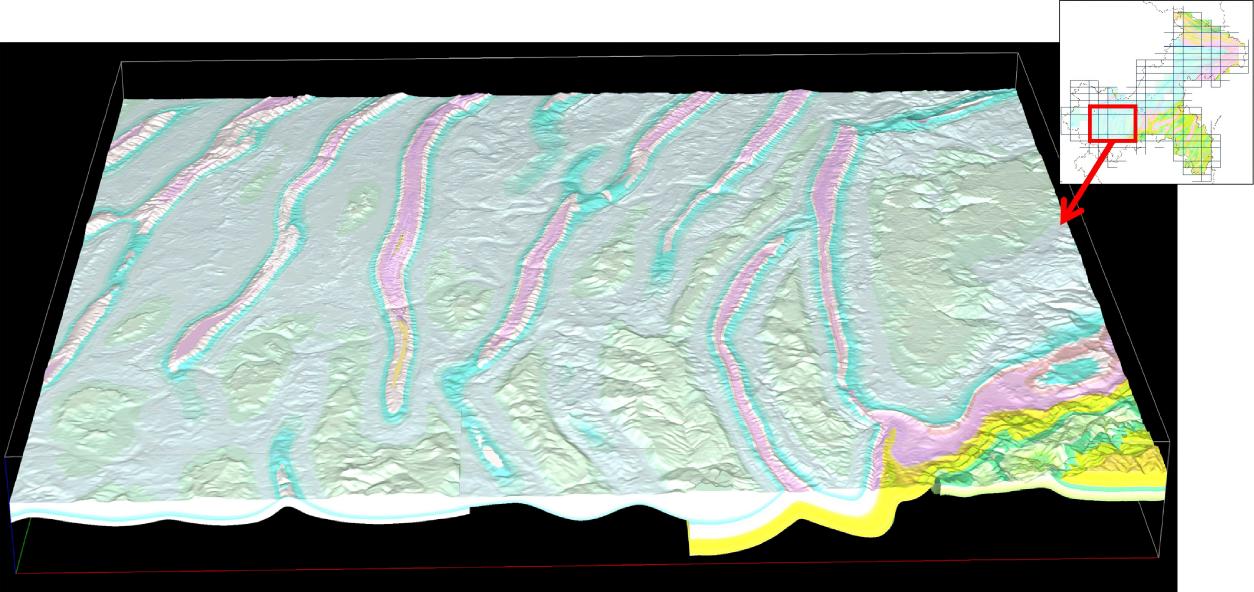
(Model Stitching Display of 25 Sheets of 1:50,000 Regional Geological Maps Covering 11,250 km²)
Efficiently Supporting Full-Domain Modeling
Efficiency is a key breakthrough for mountainous modeling, which features a wide scope and massive data volume. DepthInsight supports multi-user parallel modeling, enabling teams to work by regional partitions and greatly improving the efficiency of large-area modeling. From Mingyu Sheet and Hechuan Sheet in western Chongqing, Mawu Sheet and Shuijiang Sheet in southeastern Chongqing, to complex structural areas such as Laohuangxi Sheet and Wendou Sheet in northeastern Chongqing, the software has achieved efficient modeling and successfully completed multiple batches of map sheet stitching, integrating geological survey achievements accumulated over more than 40 years into a full-domain system.
Meanwhile, the software’s functions of dynamic update, grid generation and Web-based large-scale grid LOD display adapt to the long-term application needs of mountainous modeling. It flexibly adjusts profile intervals (about 1 km in complex areas and 1.5 km in simple areas), with a modeling depth ranging from -7,000 meters to 4,000 meters, precisely matching the needs of different regions.
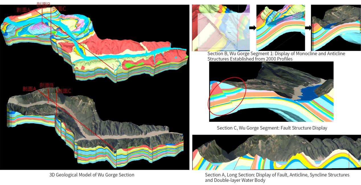
(3D Geological Model Display of High and Steep Cliffs and Dangerous Rocks in Wu Gorge)
Empowering Applications Throughout the Whole Process
This modeling effort has not only accomplished technological breakthroughs but also built a complete 3D geological model database. The model transforms abstract geological data into intuitive three-dimensional digital entities, supporting arbitrary-angle slicing and analysis, and providing digital support for the transformation of geological work from "empirical judgment" to "precise analysis and decision-making".
At present, the results have been connected to Chongqing’s Comprehensive Territorial Spatial Data Information System, providing accurate geological references for site selection of major projects such as rail transit and cross-river bridges, and a core data foundation for geological disaster monitoring and early warning, underground space planning and mineral resource exploration, truly realizing "seeking answers underground and laying a foundation for development".
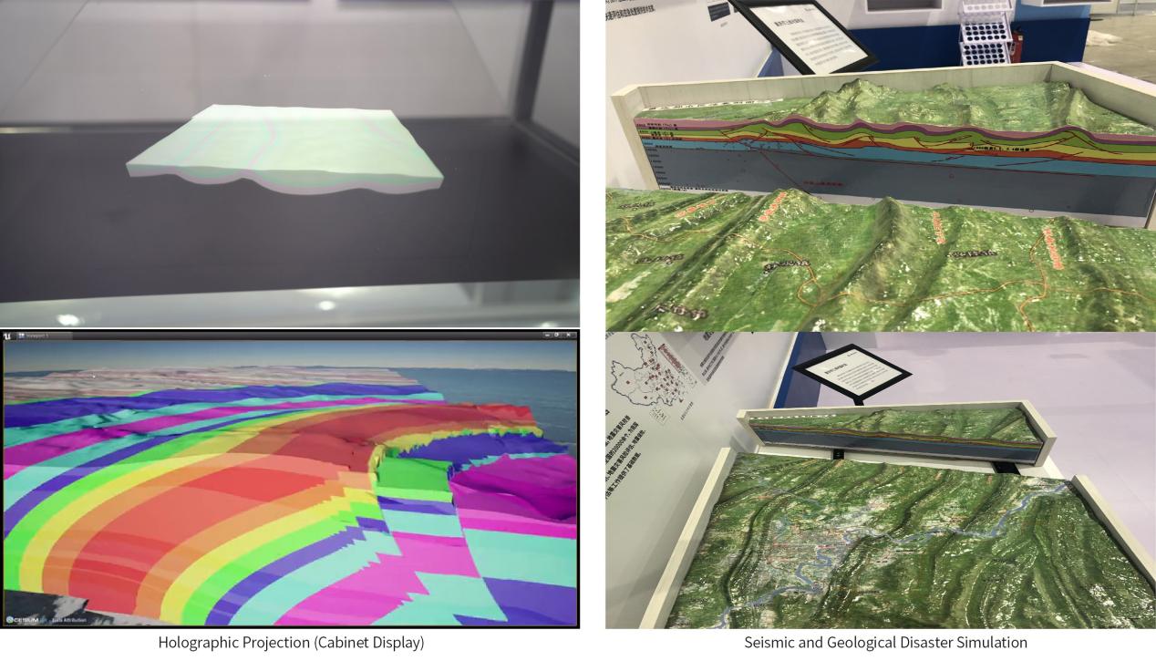
(Holographic Projection of 3D Geological Model – Geological Disaster Simulation)
As domestic software with independent intellectual property rights, DepthInsight has been widely applied in basic geological surveys, urban geology, mineral exploration and other fields, solving industry pain points through technological innovation. In the future, GRIDWORLD will continue to optimize modeling technologies, expand application scenarios, provide accurate and efficient geological modeling solutions for more mountainous areas, boost the intelligent and refined development of China’s geological industry, and lay a solid technical foundation for "marching into the deep earth" and the implementation of the digital and intelligent development strategy of the 15th Five-Year Plan.
(Images in this article are provided by Chongqing Institute of Geology and Mineral Resources)