SuperMap Launches 3D Geological Modeling Feature, Fully Powered by GridWorld’s Core Technologies
2026-10-13Geological information has long been confined to paper maps and reports, making it difficult to grasp the full picture of the subsurface. Leveraging GridWorld's technology as its foundation, SuperMap has officially launched a 3D geological modeling feature. By integrating multi-source data and utilizing professional algorithms, this feature transforms discrete information into continuous, visualizable, and computable 3D geological models, empowering geoscience research and applications.
Multi-Source Data Fusion: Reconstructing the True Subsurface
Traditional geological data is often scattered and heterogeneous, making it challenging to form a holistic understanding. This feature integrates multi-source data, including boreholes, geophysical surveys, geological maps, and field investigations. Through algorithms such as geometric reconstruction, geostatistics, and spatial interpolation, it restores discrete data points into continuous 3D models of strata, faults, and rock masses, achieving a seamless transition "from data to models, and from models to insights."
Three-Stage Progressive Modeling: Flexibly Adapting to Business Needs
The modeling workflow generally encompasses three progressive stages: structural modeling, mesh generation, and attribute modeling. For actual projects, users can flexibly select the appropriate modeling level based on data availability and business objectives, balancing efficiency with adaptability.
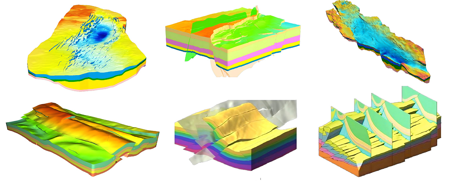
1.Structural Modeling: Building the Geometric Foundation of the Subsurface
By integrating multi-source geological information, this stage clarifies the spatial relationships among strata, faults, and geological bodies. It establishes a geometric framework that reflects the tectonic characteristics of the study area, facilitating structural visualization and the identification of spatial relationships.
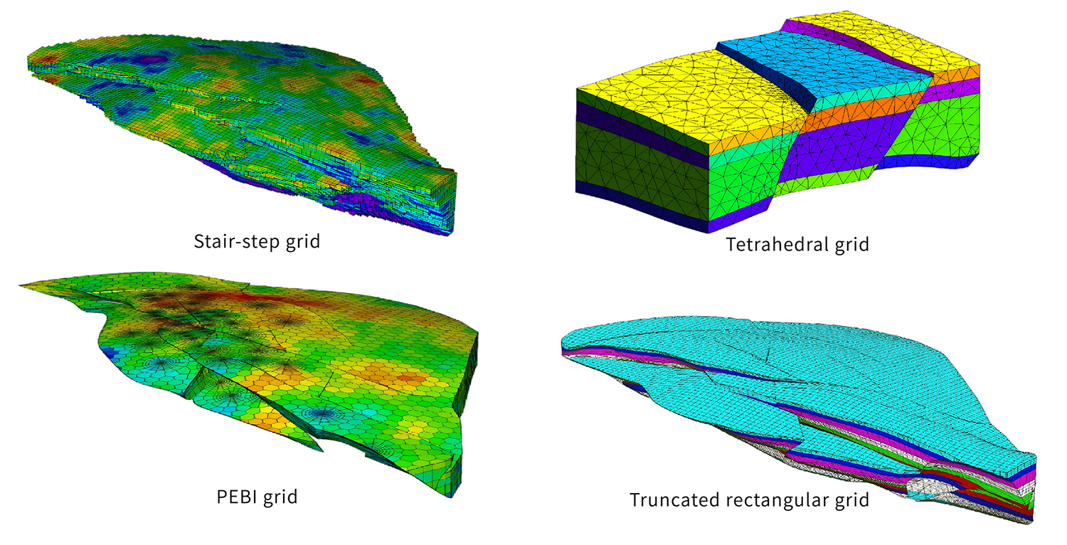
2.Mesh Generation: Making Geological Space "Divisible and Computable"
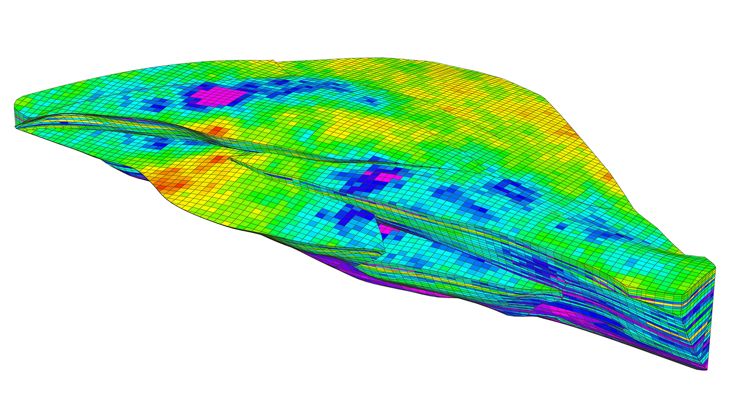
Using the structural model as a skeleton, the subsurface is divided into regular or irregular meshes. This converts the continuous geological space into a computable model, supporting numerical simulations, volumetric calculations, and detailed spatial analysis.
3.Attribute Modeling: Injecting Professional Geological Properties
This stage assigns properties such as lithology, stratigraphic age, and grade to the meshes. By linking spatial locations with professional attributes, it creates an integrated structure-attribute 3D geological model that supports resource evaluation, statistical analysis, and business decision-making.
A Powerful Alliance: Building an Intelligent Foundation for Geoscience
The launch of the 3D geological modeling feature by SuperMap, powered by GridWorld's technology, marks a significant milestone in their strategic partnership. With years of deep expertise in geological modeling, GridWorld possesses proprietary, controllable deep-exploration geoscience modeling software and a Transparent Earth engine. Meanwhile, SuperMap holds a leading position in GIS platforms and spatial intelligence. By combining their complementary strengths, they deeply integrate professional geological modeling capabilities with a multi-terminal GIS application ecosystem, providing users with end-to-end support from geological model construction to business application.
Looking ahead, GridWorld will continue to partner with SuperMap to drive the in-depth application of 3D geological modeling technologies across sectors such as natural resources, engineering construction, geological disaster emergency response, and education & research. Together, they aim to make the subsurface world "visible, computable, and highly usable," jointly building an intelligent future for understanding the Earth.