

On March 27, the 2026 Spatial Intelligence Software Ecology CTO Salon, guided by the China Association for Geographic Information Industry and hosted by SuperMap Software, was held in Wuxi.

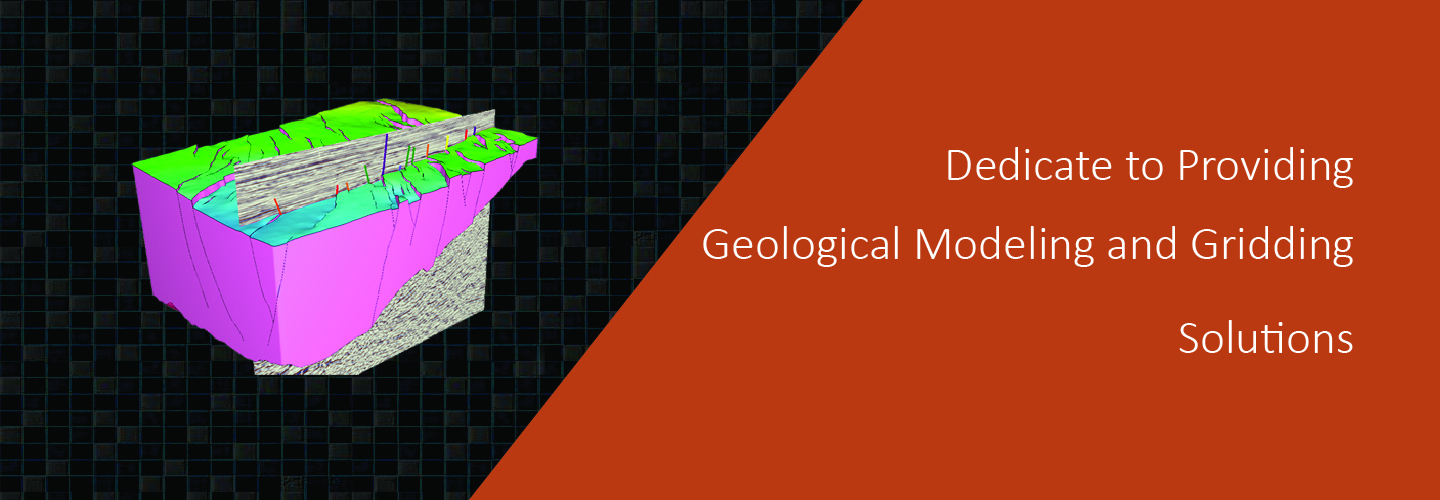
a completely new approach to the science of 3D grid generation and model description solves major weaknesses still inherent in even the most current geomodeling technologies commonly used today.
construct grids of any size and type.No limits.
automation speeds the creation of workflows and results.
much easier to construct accurate representations of complex subsurface geology.
increased productivity for geoscientist due to a short learning curve, saves time and money operational costs, but also in drilling and production costs with a more accurate reservoir description and better analysis and planning.
Geomodeling & Gridding Algorithms
On March 27, the 2026 Spatial Intelligence Software Ecology CTO Salon, guided by the China Association for Geographic Information Industry and hosted by SuperMap Software, was held in Wuxi.
The 2026 National Two Sessions focused on deep earth exploration, geological informatization and the development and utilization of natural resources. Marching into the deep earth