
From Geological Labyrinth to Transparent Mine: How GridWorld Reshapes the Future of Coal Mines with Its Digital Foundation
2026-02-24In the coal mining industry, the complexity of geological conditions has long affected safe production and efficient mining. Imagine a scenario where the entire mining area’s geological structure, coal seam distribution, fault trends, and even subtle changes in every dirt band are clearly presented to engineers in 3D. This is not science fiction, but a real transformation brought by GridWorld’s multimodal modeling and simulation digital foundation technology.
1. Building a Real 3D Geological Framework
The technology starts with a basic geological model. The system integrates all geological data of the mining area—including sectional drawings, borehole data, and geophysical exploration information—to construct a three-dimensional geological model covering coal seam distribution, seam boundaries, and fault structures across the entire mine. This not only visualizes geological structures but also exposes hidden geological features, providing a reliable basis for mining planning.
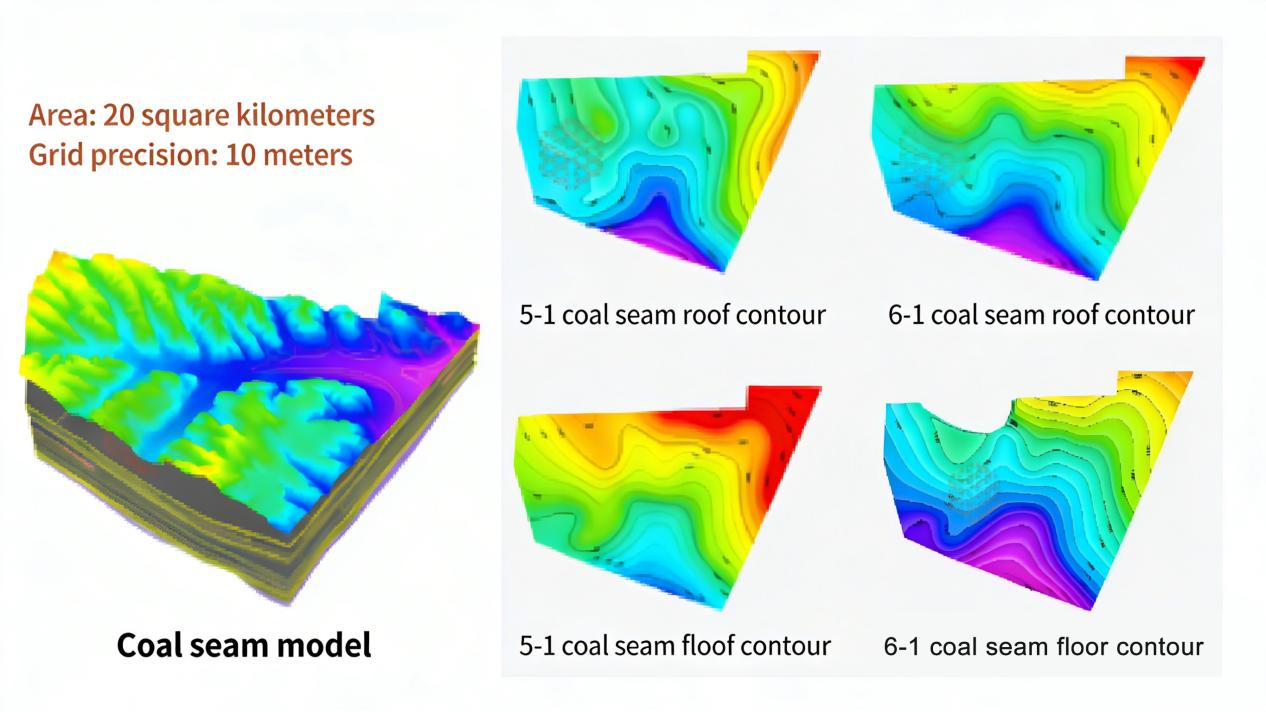
2. Focusing on Coal Seams for Refined Management
Based on the overall framework, the coal seam model is further refined. The system independently models each coal seam in the mining area and generates top and bottom contour maps for each seam. This step makes seam undulation, thickness variation, and spatial distribution crystal clear, like conducting a high-definition 3D survey of coal seams, supporting the precise design of mining schemes.
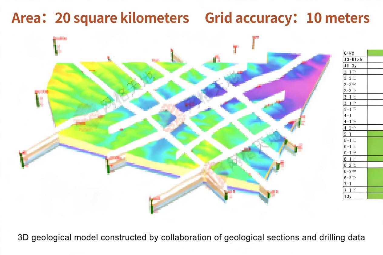
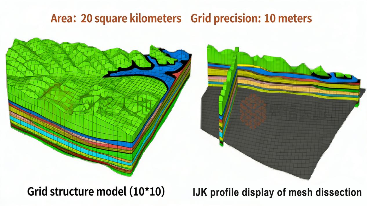
3. Grid Division—From Model to Data Foundation
The real breakthrough lies in the basic geological grid model. The technology performs 3D division of the entire geological model at a grid scale of 10m×10m×2m. Each small cube carries independent geological attributes, transforming the overall model into a computable and analyzable structured data foundation. This is equivalent to a pixel-level scan of the earth, realizing quantified and unitized management of geological information.
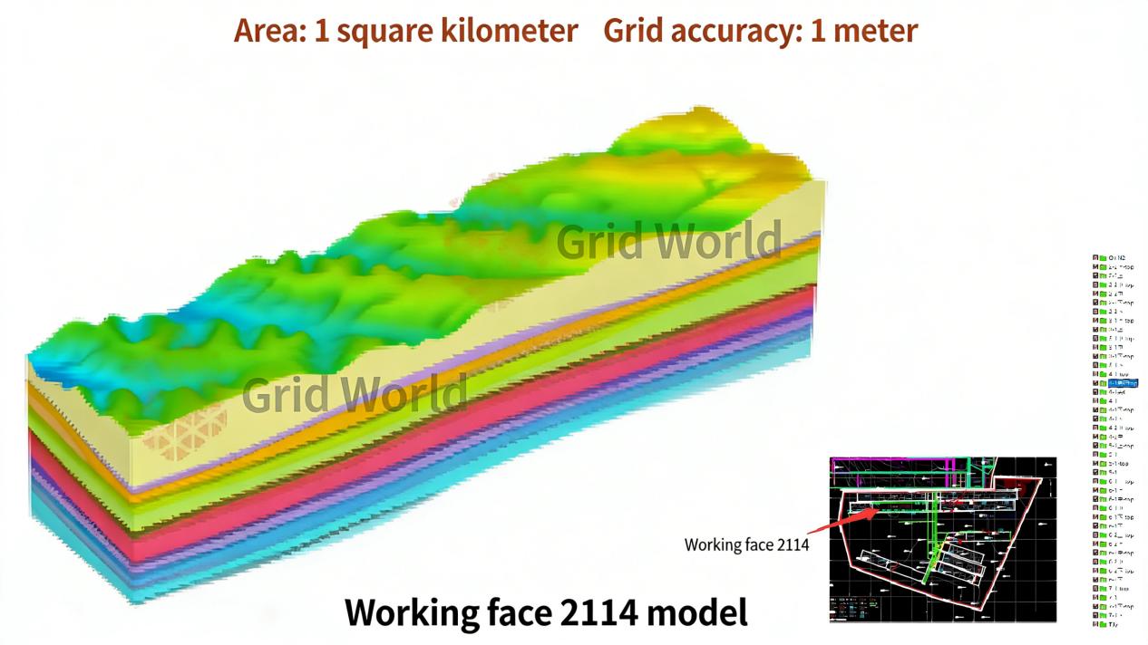
4. Integrating Dirt Bands for Realistic Mining Scenarios
Finally, the system incorporates borehole dirt band data from working faces into the model. As rock interlayers within coal seams, dirt bands directly impact shearer operation and coal quality control. With this information added, the model evolves from a “geological model” to an “engineering geological model,” better matching actual mining scenarios and providing a basis for advance judgment in working face layout, equipment selection, and process optimization.
The Digital Revolution of Transparent Mines
These four steps build more than just a geological model—they create a simulation digital foundation integrated with multi-source data. It forms an extensible digital twin system, achieving a leap from “describing geology” to “simulating geology” and supporting multi-dimensional analyses such as mining simulation and disaster deduction.
This technology drives coal mines from experience-driven to data-driven operations, making hidden geology transparent and gridded, and moving risk prediction forward to the planning stage. As data and algorithms continue to evolve, this “mine digital twin” will become an indispensable core engine for intelligent coal mining, continuously empowering safe and efficient extraction.